WHAT IS NATURAL FLOOD MANAGEMENT?
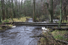
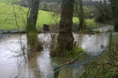
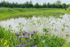
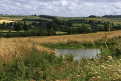
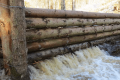
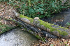
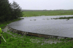
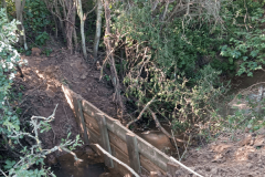
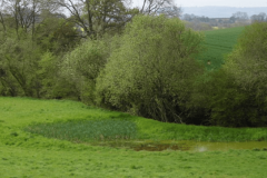
Natural Flood Management measures include the creation of ponds, water retention areas and leaky dams to hold back and/or divert water run off. These features can combine with strategic tree and hedge planting to improve soil permeability – especially important on our catchment’s heavy clay.
It’s cheaper than hard engineered schemes (about 10% of the comparative cost to achieve the same result). It is achievable because it can be carried out in phases, and is already proven to be effective and successful.
As well as helping reduce the risk of flooding NFM is ecologically friendly, reducing sediment and phosphate run off, cutting down erosion of river banks, creating wetlands and new ecosystems and improving water quality. These factors are all forward looking solutions in the face of climate change and government attitudes and grant schemes are changing towards supporting them.

BENEFITS OF NATURAL FLOOD MANAGEMENT
REDUCING FLOOD RISK
NFM can help to slow the flow of water through a catchment, by reducing run off and increasing the ability of catchments to hold water which can help to reduce river peak flows.
FINANCIAL INCENTIVES
The Countryside Stewardship Scheme has a range of grants for farmers and land managers who wish to adopt NFM techniques. These can be capital items or management options, for example in stream structures or river bank restoration. Facilitation funds may be available in your area to assist with your application and provide up to a 20% uplift to your score.
BIODIVERSITY & CONSERVATION
Wetlands are one of the most biologically diverse ecosystems due to high nutrient levels and primary productivity. Woodland creation encourages development of a wide range of species beneath the tree canopy. Improved water quality also has the potential to improve in stream habitats for wildlife.
SEDIMENT MANAGEMENT
NFM can improve soil structure, reduce loss of top soil and increase soil productivity which can in turn increase agricultural productivity. Measures such as run off pathway management and offline storage areas can help with sediment capture, preventing soil erosion and loss of sediments and fertilisers into the watercourse.
HABITAT CREATION & IMPROVEMENT
Creating habitats such as wetlands, which are one of the most biologically diverse ecosystems, not only improves biodiversity but also improves connectivity between wetlands allowing more species to move between habitats. Developing green spaces also has massive social benefits, providing better access to green spaces, improving the environment we live in and improving quality of life.
IMPROVING WATER QUALITY
Improvements in soil structure through woodland creation or less intensive land management increases rates of infiltration. Reconnection of wetlands can help to manage high nutrient loads and reduce siltation, contributing to improvements in the status of water bodies.
REDUCED EROSION
By slowing the flow NFM can help reduce watercourse bank erosion, soil loss and sediment transfer.
RESILIENT ECOSYSTEMS
Wetlands and woodlands are efficient at accumulating and storing carbon and removing carbon dioxide from the atmosphere. Measures that reduce surface runoff and soil erosion, such as contour cultivation, can also reduce carbon loss from soil.
IMPLEMENTING NATURAL FLOOD MANAGEMENT - CASE STUDY LONG COMPTON
Natural Flood Management can be used to mitigate flood risk on a single stretch of water, or across an entire river catchment. Our general approach is always the same, and we break down the task into six manageable projects. A typical scheme will take 6-8 months from start to finish. Below you can see a case study for Long Compton:

STEP 1
Get To Know The Catchment And Terrain
The River Stour at Shipston is fed by multiple tributaries across 190 sq km. Using available modelling software, we were able to identify that water flowing from Long Compton in the south of the catchment is a major contributor. A more detailed view of that area shows us the main tributaries upstream of Long Compton that are candidates for NFM measures.

STEP 2
Engage The Local Community
Long Compton has its own flood issues and its own Flood Action Group. They were able to tell us where the major flows came from, and who owned the land where NFM measures might be appropriate.

STEP 3
Develop A Baseline Plan
Having secured the necessary permissions, SAFAG walked the main watercourses around Long Compton to identify NFM opportunities (water storage areas, leaky dams, wet woodland areas etc.) and produced initial proposals for discussion with landowners. Left: Baseline Plans for Long Compton – 4 schemes.

STEP 4
Obtain The Necessary Consents And Engage Contractors
We received feedback from landowners and farmers for each of these 4 schemes, and refined our plans. We then obtained written Letters of Support for our NFM proposals, and agreed implementation dates. In all cases, we required Consent from the Lead Local Flood Authority (LLFA) – in this case Warwickshire County Council – which is typically an 8-10 week process. This can include Specialist Hydrological Modelling for larger ponds or bunds. In the meantime, we engaged different approved contractors to obtain quotes and implementation dates for each of the schemes.

STEP 5
On day 1 of any implementation project, we meet with the landowner/farmer and the contractor to walk the land, understand any constraints and confirm locations and design requirements. After that, it’s periodic review of progress and any issue management, before a final quality review and signing off completed works (ensuring that the landowner is happy!).

STEP 6
We then added information on any new features to the national NFM database (AGOL), including location, dimensions and two photographs, and agreed monitoring responsibilities with the local flood group.
WHAT IMPACT ARE WE HAVING?
With guidance from the Environment Agency and support from local conservation groups we are measuring the impact of key NFM interventions in the catchment on an ongoing basis (particularly ponds and woodland areas), via water quality testing and structured surveys of the rivers (MoRPh surveys).
Under the MoRPh methodology, a baseline survey of a stretch of river is conducted prior to NFM implementation, and thereafter every six months or so to assess the changes in vegetation, water quality and other river characteristics. Our surveys are then uploaded in to a national MoRPh database.
If you’d like to get involved in this very important work, please go to our VOLUNTEER page to find out more, or email geoff.smith@safag.org
